- (479) 785-2865
- 3501 S Gary St, Fort Smith, AR
About Us
About Us
Who We Are
ProVision Spatial provides advanced LiDAR scanning, Ground Penetrating Radar (GPR) investigations, and utility locating services for clients throughout Arkansas, Oklahoma, and Missouri. Using industry-leading geospatial technology, we help contractors, engineers, architects, municipalities, surveyors, and property owners gain a clearer understanding of site conditions before construction, excavation, renovation, and development projects begin.
From documenting existing infrastructure with high-accuracy LiDAR scanning to locating underground utilities and investigating subsurface conditions with Ground Penetrating Radar, our team delivers the reliable data clients need to make informed decisions and reduce project risk. Every project begins with accurate information, and our goal is to provide the spatial intelligence that helps projects move forward safely, efficiently, and confidently.
Based in Fort Smith, Arkansas, ProVision Spatial proudly serves communities across Arkansas, Oklahoma, and Missouri, providing professional geospatial solutions that support planning, design, construction, infrastructure management, and property development projects of all sizes.
FAQs
Frequently Asked Questions
LiDAR (Light Detection and Ranging) scanning uses laser technology to capture highly accurate three-dimensional measurements of buildings, infrastructure, terrain, and project sites. The resulting data can be used for planning, engineering, design, asset management, and documentation.
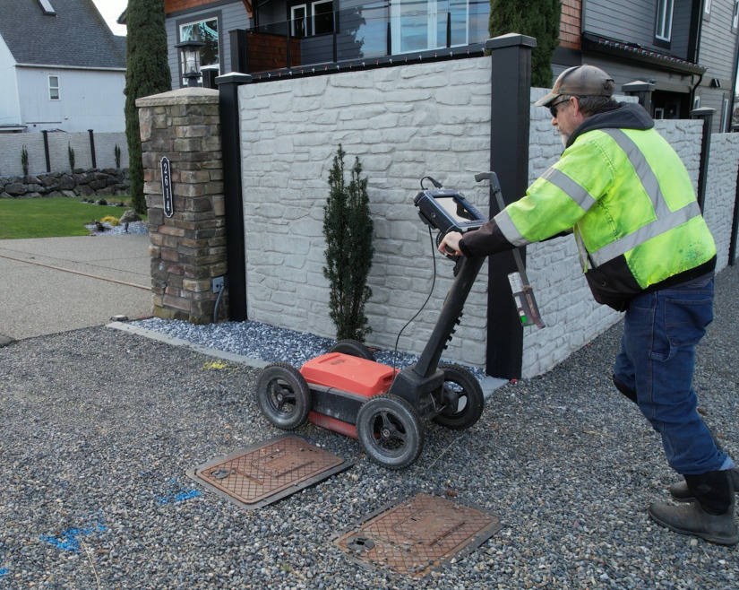
Ground Penetrating Radar (GPR) is a non-destructive technology used to detect and map subsurface features. GPR can help identify buried utilities, rebar, post-tension cables, voids, underground structures, and other hidden site conditions.
Utility locating should be performed before excavation, trenching, drilling, demolition, or construction activities. Identifying underground utilities beforehand helps improve safety and reduce the risk of costly utility strikes.
LiDAR scanning is commonly used for commercial construction, industrial facilities, infrastructure projects, renovations, as-built documentation, engineering design, architectural planning, and facility management.
GPR is a powerful tool for identifying many underground features, but results can vary based on soil conditions, utility materials, depth, and site characteristics. GPR is often used alongside utility locating equipment to improve accuracy and confidence.
We work with engineering firms, architects, contractors, municipalities, utility providers, industrial facilities, commercial property owners, educational institutions, healthcare facilities, and infrastructure agencies.
Depending on the project, deliverables may include utility maps, marked utility locations, point clouds, CAD files, subsurface investigation reports, reality capture data, and other project-specific documentation.
Modern LiDAR systems can capture highly detailed measurements with exceptional accuracy. Accuracy levels vary based on project requirements, site conditions, equipment, and data processing specifications.
Yes. ProVision Spatial provides LiDAR scanning, GPR investigations, and utility locating services throughout Arkansas and Oklahoma, including Fort Smith, Springdale, Fayetteville, Rogers, Bentonville, Tulsa-area communities, and surrounding markets.
Simply contact our team to discuss your project. We'll review your needs, answer questions, and recommend the appropriate scanning, locating, or investigation services for your site.
Advanced Technology
We utilize modern LiDAR scanners, Ground Penetrating Radar systems, and utility locating equipment to capture accurate and actionable data.
Reduce Project Risk
Identify potential conflicts before excavation, construction, or renovation begins.
Fast Turnaround
Efficient field collection and data processing help keep projects moving forward.
Accurate Deliverables
Receive dependable information that supports engineering, design, planning, and construction decisions.
Regional Coverage
Serving clients throughout Arkansas and Oklahoma from our Fort Smith headquarters.
Why Choose ProVision Spatial?
Why choose us
Successful projects begin with accurate information. Our team combines advanced geospatial technology with practical field experience to provide detailed site intelligence for projects of all sizes.